Thinking Spatially is an annual mapping event designed to bring campus and community members together around a common theme. Speakers and data sources offer attendees an interdisciplinary approach to further explore the spatial context of historic and current events, as well as the opportunity to identify and recognize the value of data visualization and the role of maps in presenting data.
Thinking Spatially is presented by the Institute for Advanced Study, the John R. Borchert Map Library, Mapping Prejudice, University of Minnesota Libraries, and U-Spatial.

2023 Thinking Spatially Symposium: Indigenous Data Sovereignty
Friday, October 27, 2023
10:00 a.m.–12:30 p.m.
Hybrid: Online & Northrop, Crosby Seminar Room
FREE & open to the public
Concepts of Indigenous data sovereignty challenge the western academic perspectives on information, data, and ownership. Join us at the 6th annual Thinking Spatially symposium for a series of presentations featuring projects and Indigenous researchers exploring issues of data ownership and access, including spatial data, including how these issues need to be approached in research and public communication. Who should have access to what knowledge, and in what circumstances? How do researchers navigate these issues while working within a large research institution? Join us as panelists discuss how they navigate issues of data sovereignty in their own work and with community partners.
Featuring: Gabby Menomin, Deacon DeBoer, and An Garagiola, moderated by Sean Dorr.
9:30 Refreshments
10:00 Introductions & Individual Presentations
11:20 Panel Discussion
12:30 End
Past Events
2022: Indigenous Mapping
2022 Thinking Spatially Symposium: Indigenous Mapping
Friday, October 21, 2022
9:00 a.m.–12:00 p.m.
Online & Northrop, Best Buy Theater
FREE & open to the public
The 5th annual Thinking Spatially symposium explored the topic of Indigenous mapping and cultural connection to place. Maps are most often seen as documents of truth that describe where and what geographic features are by ways of symbolization and textual labels. We make assumptions that maps are wholly factual documents, but they too are a subjective creation. What is the map not telling us and to whom does this concern? Together, we examined historical truths and explored the use of maps to better understand the disenfranchisement of Indigenous communities as a result of the University land-grab that took place following the Morrill Act and how the simple impact of labeled geographic locations impacts entire communities.
Presented by the Institute for Advanced Study, U-Spatial, University of Minnesota Libraries, and DASH. In partnership with the Center for Premodern Studies; Center for Urban and Regional Affairs and the Resilient Communities Project; Department of Geography, Environment and Society; Department of History; the Mellon Environmental Stewardship, Place, and Community Initiative; and the East Side Freedom Library.
This year’s Symposium was also live streamed at the North American Cartographic Information Society’s (NACIS) annual conference, which took place in Minneapolis, October 19–22, 2022.
2021: Mapping Civic and Community Engagement
Mapping Civic and Community Engagement
September 24, 2021
9:00 a.m.–12:00 p.m.
Online
Join us at the 4th annual Thinking Spatially symposium as we explore the topics of Civic and Community Engagement. Approaching our own communities from a geographic perspective may help to provide clarity as we work to make these places safer, more sustainable, and more equitable places to live. How are the shapes of communities changing over time, and why? How do we bring sustainable social justice into the community? How do we invest locally to create environments in which diversity and racial equity thrive? This symposium offers a look into a variety of local projects that are working to answer these and similar questions. Additional presentations will provide an overview of the data, tools, and software resources available at the University of Minnesota, including Esri Story Maps.
Thinking Spatially: Mapping Civic and Community Engagement will appeal to everyone interested in urban planning, local projects that are tackling some of the most important issues of the day one neighborhood at a time, or projects that help to identify where civic and community action are most needed. All faculty, staff, students, and community members are invited to join us at this free event via Zoom.
2020 Symposium: Mapping Politics and Polarization
September 2020
What are the drivers of polarization and how do they affect political perspectives? Can maps help us to interpret the divisiveness more efficiently? Thinking Spatially: Politics and Polarization is for everyone interested in politics, partisanship, idealism, voting patterns, racism, civil rights, community development, mapping, and more. All faculty, staff, students, and community members are invited to join us at this free, online event.
2019 Symposium: Mapping Environmental Justice
“Environmental justice” has been a popular buzzword in social science research in recent years. The concept has been used to examine issues ranging from disaster relief and climate change to food security. To start understanding environmental justice, we need to think through historically rooted understandings of environmental issues to help imagine radical solutions.
This workshop is for everyone interested in topic such as community development, politics, racism, civil rights, industrialism, food security, or environmental discrimination. Spatial relationships help to define factors that diminish social equity, environmental safety, and ultimately, quality of life. Mapping Environmental Justice offers perspectives from invited speakers who will share their scholarly work surrounding the intersection of the environment and equity, as well as opportunities for participants to learn story mapping, and spatial data availability.
Focusing on this topic of environmental justice, we call on all faculty, staff, students, and community partners to participate. Bring your talent and curiosity to apply an interdisciplinary approach to further explore the spatial context of environmental justice. This all-day event is designed to bring people together into working groups based on common themes (defined by the workshop participants). To compliment the participant expertise brought to the workshop, working groups will also have the support of library, mapping, and data science experts to help gather, create, and organize the spatial components. Working groups that develop from this event are eligible to receive an award for completed projects.
2018 Symposium: Mapping 1968: Conflict and Change
1968 was one of the most turbulent years of the 20th century. 2018 marks the 50th anniversary of that year’s landmark political, social and cultural events–events that continue to influence our world today.
Focusing on the importance of this 50 year anniversary we are calling out to all faculty, staff, students, and community partners to participate the workshop ‘Mapping 1968, Conflict and Change’. This all-day event is designed to bring people together into working groups based on common themes. Bring your talent and curiosity to apply an interdisciplinary approach to further explore the spatial context of these historic and/or current events. Learn new skills on mapping techniques that can be applied to any time in history. To compliment the expertise that you bring to the workshop, working groups will also have the support of library, mapping, and data science experts to help gather, create, and organize the spatial components of a given topic.
Sample Projects
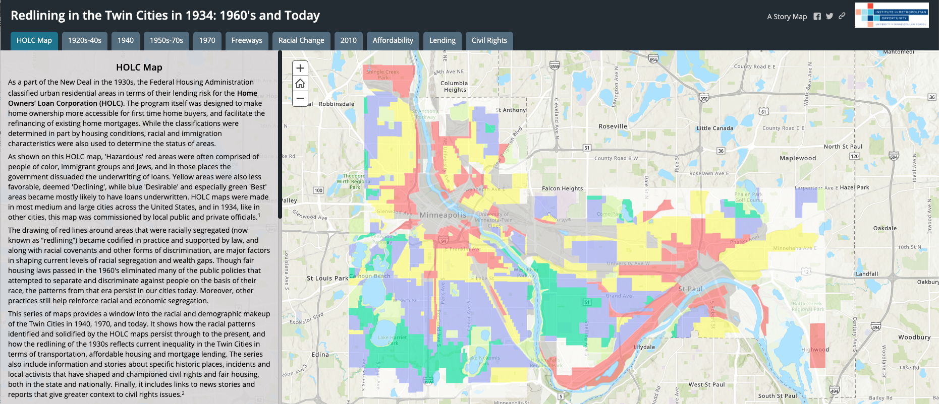
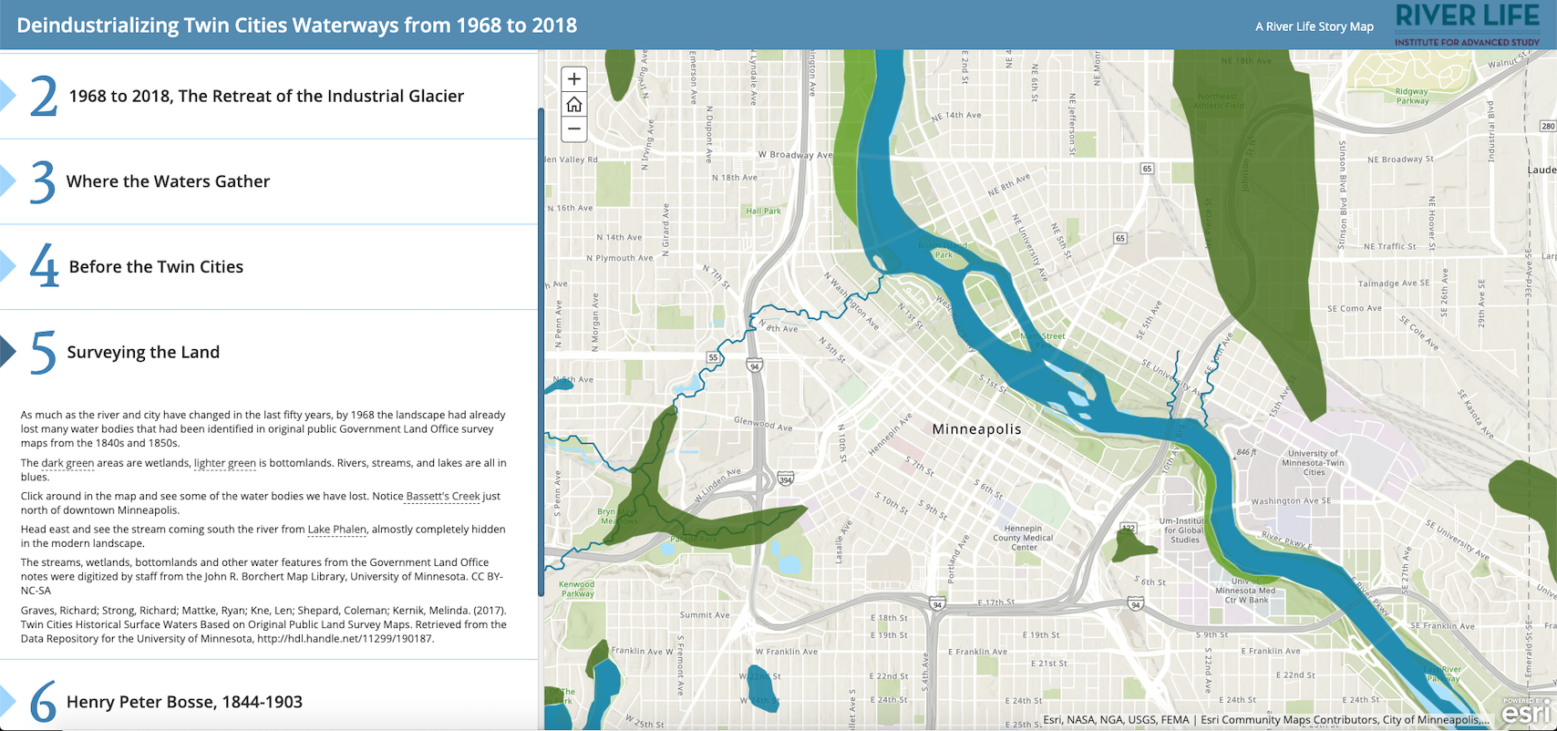
Participants at the annual Thinking Spatially symposium are invited to create their own map, with the feedback of their group. Here are just a few examples of what participants have created.
Redlining in the Twin Cities in 1934: 1960s and Today
by Eric Myott, Law School Institute on Metropolitan Opportunity
Deindustrializing Twin Cities Waterways 1968–2018
by Joanne Richardson, River Life & Open Rivers, Institute for Advanced Study

