Friday, September 24, 2021
9:00 a.m.–12:00 p.m. CDT
An Online Symposium
Join us at the 4th annual Thinking Spatially symposium as we explore the topics of Civic and Community Engagement. Approaching our own communities from a geographic perspective may help to provide clarity as we work to make these places safer, more sustainable, and more equitable places to live. How are the shapes of communities changing over time, and why? How do we bring sustainable social justice into the community? How do we invest locally to create environments in which diversity and racial equity thrive? This symposium offers a look into a variety of local projects that are working to answer these and similar questions. Additional presentations will provide an overview of the data, tools, and software resources available at the University of Minnesota, including Esri Story Maps.
Thinking Spatially: Mapping Civic and Community Engagement will appeal to everyone interested in urban planning, local projects that are tackling some of the most important issues of the day one neighborhood at a time, or projects that help to identify where civic and community action are most needed. All faculty, staff, students, and community members are invited to join us at this free event via Zoom.
Schedule
9:00 a.m. WELCOME & PRESENTATIONS
- Tim Griffin
Senior Research Fellow, Minnesota Design Center
Participatory Geodesign for Regenerative Community Futures
Design for Community Regeneration (D4CR) partners with communities in a process of imagining and planning their resilient future addressing food, water, and energy security while increasing economic opportunities, social cohesion, and finding low cost housing options. Communities participate in a ground-up “Geodesign” process assisted by geographic data, and a dashboard for community goals. Taking a local and regional perspective, communities explore how to identify their assets of land such as underutilized golf courses, school properties, and industrial sites and participate in an inclusive decision process about future regenerative land use yielding initiatives ready for prototyping and then implementation. D4CR is a Minnesota Design Center initiative led by Tim Griffin, Jonee Brigham, and Dewey Thorbeck. Tim Griffin will present the methods, results, and next steps from phase 1 of the pilot project in Warren, MN. www.design4cr.net
- Amalea Jubara
Twin Cities Mutual Aid Project
Mapping Community Aid Networks: Lessons on Solidarity and Access
The Twin Cities Mutual Aid Project (TCMAP) is a decentralized volunteer-led organization that provides an interactive open-source tool to coordinate mutual aid efforts across the Twin Cities. Through an aggregate online map, TCMAP traces aid collaboration and community care networks in the Twin Cities. The collective aims to build access to—and knowledge about—community resources, to push back against the power relations embedded in historical mapmaking processes and support participatory mapmaking shaped by public need rather than private interest. In doing so, TCMAP visualizes landscapes that are shaped by mutuality, community, and care, challenging notions of place and property.
BREAK (about 10:12–10:20)
- Rebecca Walker
NSF Graduate Research Fellow & Humphrey School of Public Affairs, UMN
Greenspace, White Space: Race, Real Estate, and the Minneapolis Park and Recreation Board
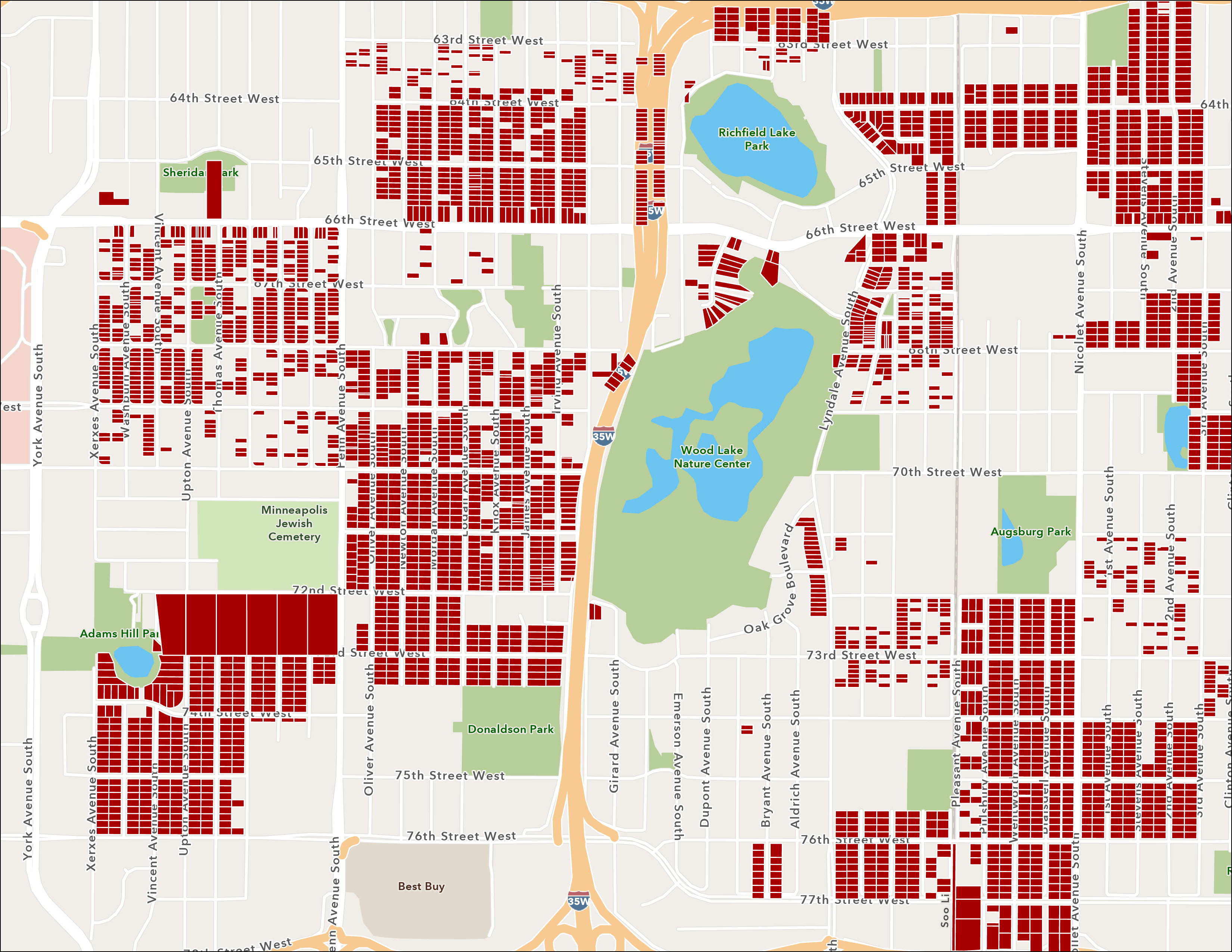
Minneapolis, MN is arguably defined by its award-winning park system and its deep and persistent racial disparities; I explore the intertwined history of racial inequality and parks in Minneapolis. Using the first complete digitized metro-wide map of racial covenants and archival data from 1910-1930 on greening campaigns by the Minneapolis Park and Recreation Board, I examine how real estate developers used legal and infrastructural technology to transform Minneapolis’s physical and social landscape. Through both parks and racial covenants, developers capitalized on the ideas of both Whiteness and idealized “nature,” creating exclusive White spaces of environmental privilege. This history resulted in environmental inequalities that are persistent in Minneapolis today. Through this research, I consider how nature is mobilized in the racialization of space, with implications for the politics of greenspace in cities today.
- Fernando Burga
Assistant Professor, Urban and Regional Planning & Public Policy, HHH; University of Minnesota
Minneapolis Panorama: Visualizing a history of the future in Minneapolis
The Minneapolis Panorama is a digital project which aims to chart the physical transformation of Lake street and West Broadway corridors following the murder of George Floyd. These streets represent historic corridors, cultural destinations, and economic centers for many of Minneapolis’s most resilient residents.The reconstruction of Lake Street and West Broadway will bring capital, people and redevelopment ideas to the corridors. How will this focus impact the needs of residents who are the most disenfranchised? The panoramas aim to provide a visual diagnostic of physical change over time to address this question from the perspective of the pedestrian.
11:25 a.m. U-SPATIAL RESEARCH SERVICES & SUPPORT
- Stacey Stark
U-Spatial
Located on both the Duluth and Twin Cities campuses, U-Spatial supports all five campuses with workshops, one-on-one consultation, and research collaboration. In this session, you'll not only learn how to access our services—we’ll also dive into examples of U-Spatial initiatives, demonstrating how you can successfully integrate spatial thinking, data, and analysis into your research or teaching.
11:45 a.m. DISCUSSION
Sponsored by: Institute for Advanced Study, U-Spatial, UMN Libraries/DASH, and LATIS.
