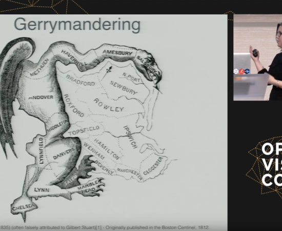
Borders often do not have much to do with the physical world. The edges of voting districts, cities, counties, states, and countries are decided by human processes, always implicitly if not explicitly political. Data are often provided preaggregated at a particular spatial polygon level. For example, data on poverty is collected at the blockgroup level, while data on education is easiest to obtain for school districts. This makes it difficult to combine data, and can lead to problems when data does not make sense at the level it was collected. In this talk, Amelia McNamara, University of St. Thomas Assistant Professor in the Department of Computer & Information Sciences, will discuss issues related to spatial polygon choices, like gerrymandering and the Modifiable Areal Unit Problem.
This talk is cosponsored by the Digital Arts, Sciences, & Humanities (DASH) program's The Human in the Data series, the University of Minnesota Libraries, U-Spatial, the Informatics Institute, and the School of Public Health's Division of Biostatistics.